There It Is, Take It! (2019- )

There it is, Take it! is a photography project of the overall geological and historical features about the Los Angeles Aqueduct, which is built from Owens valley, Inyo county to San Fernando valley, LA county. The Owens Valley is located between the mountains of the Sierra Nevada and the dryland of the Inyo Mountains. The water from the aqueduct flows across the desert and through the Transverse Ranges into San Fernando Valley, over 400 miles with different climates and ecosystems. From the late 19th century, private individuals operating as proxies for the city purchased most of the water adjacent land in the Owens Valley, and thereby completely controlled the water resource to Los Angeles. When William Mulholland said “there it is, take it” in 1913, nearly 90 percent of groundwater in the valley and all the water from Owens River was being delivered to the city from the aqueduct. The aqueduct deeply hurt the local agricultural community and the rights of native Americans, but it also was the main factor that built the modern LA city. As a result of the aqueduct, the ecosystem and economy in the Owens Valley collapsed rapidly in the next 10 years, and the Owens Lake was desiccated in 1924 and became a huge dust bowl until the new millennium.
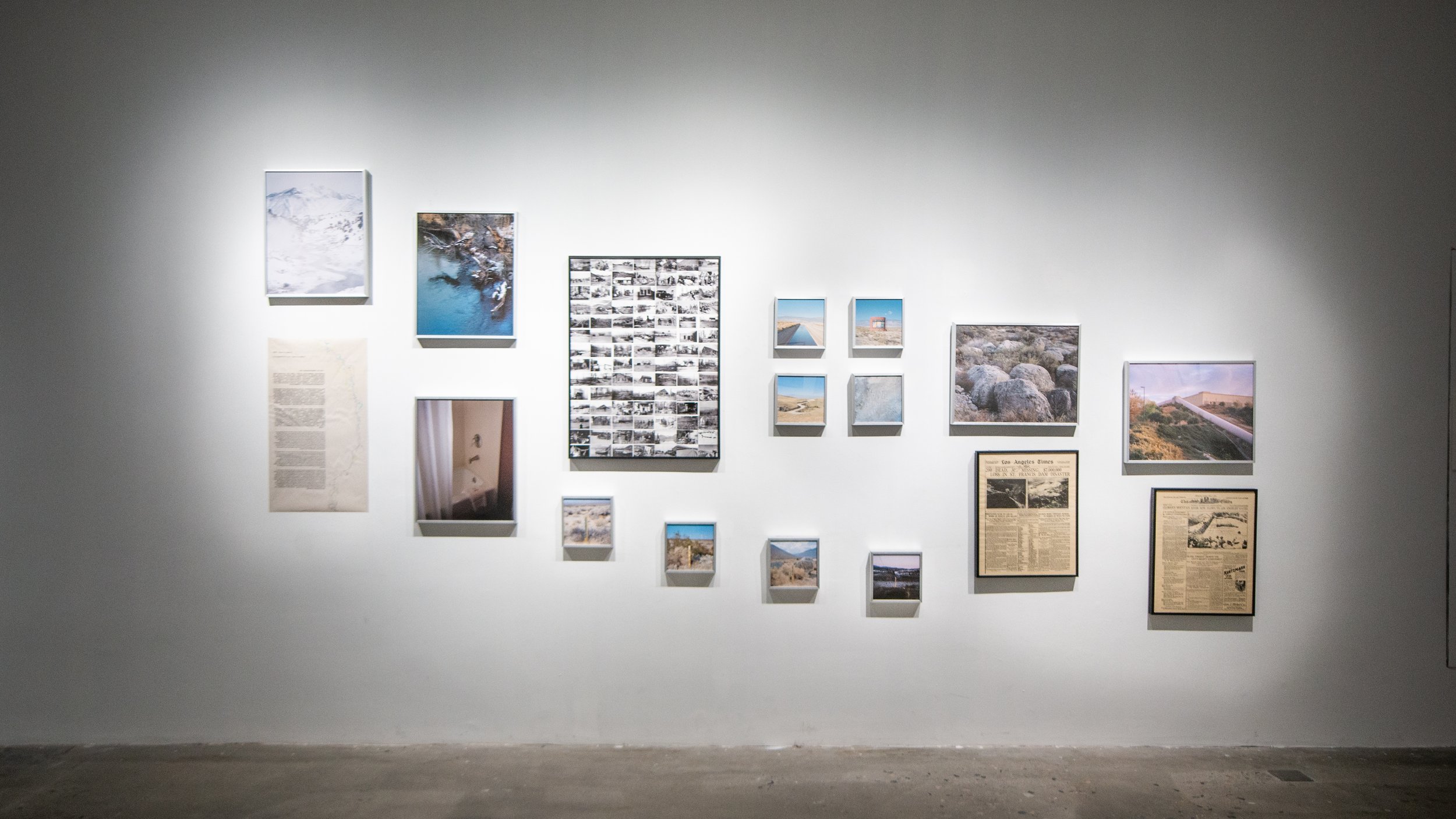
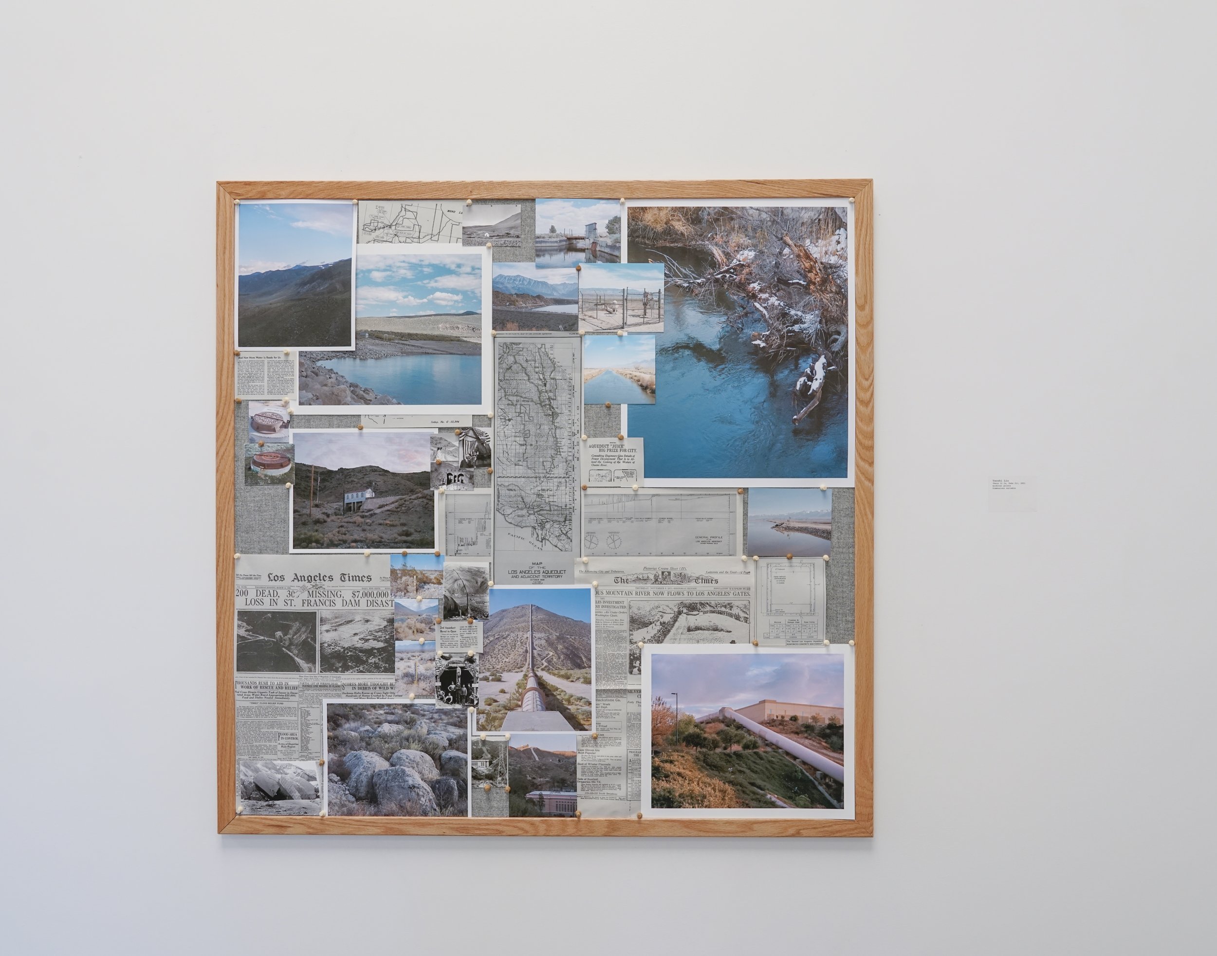
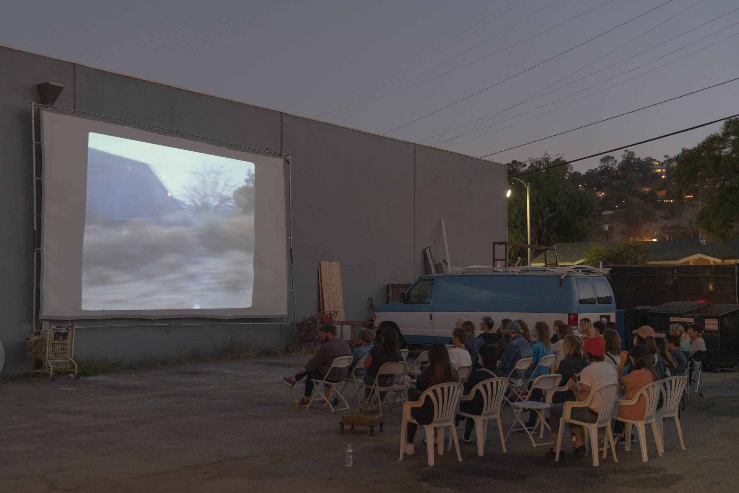
By incorporated photographs, videos, maps, newspapers, related documents, and art installations, this project wants to reveal the structures of LA aqueduct, includes siphons, dams, reservoirs and canals, the surrounding environments of the aqueduct, from eastern Sierra to Santa Clarita valley, and the history of the aqueduct by using historical documents and archival photographs.